Severe Cyclone Remal is expected to strike the Bengal-Bangladesh coast between 11 pm on Sunday and 1 am on Monday, with Kolkata set to experience the storm’s impact from Sunday afternoon until Monday afternoon. Wind speeds are predicted to reach 70-80 km/h, with gusts up to 90 km/h, and heavy rainfall of up to 200 mm is forecast.
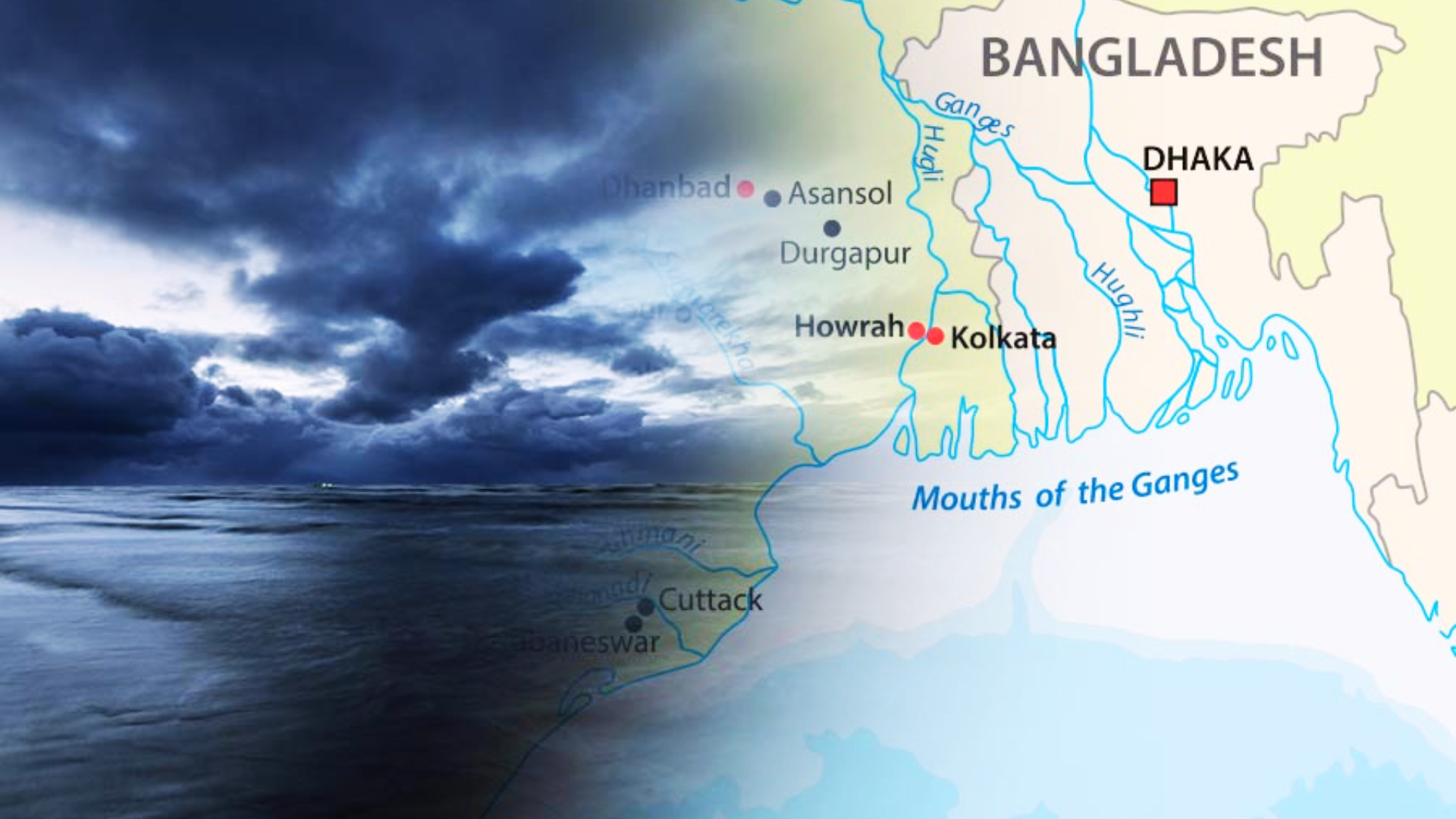
By 5:30 pm on Saturday, Cyclone Remal intensified over the north and east-central Bay of Bengal, positioned 360 km southeast of Khepupara in Bangladesh and 390 km southeast of Canning in Bengal. The cyclone is expected to make landfall between Khepupara and Sagar Island around midnight, bringing winds of 110-120 km/h, with gusts up to 135 km/h, to the coastal regions of Bengal and Bangladesh.
#WATCH | West Bengal: As per IMD, cyclone ‘Remal’ is to intensify into a severe cyclonic storm in the next few hours and cross between Bangladesh and adjoining West Bengal coasts around May 26 midnight as a Severe Cyclonic Storm
(Visuals from Sundarbans, South 24 Parganas) pic.twitter.com/1yp3xRxUPr
— ANI (@ANI) May 26, 2024
Kolkata falls within the “high impact zone” and is predicted to experience significant effects within the first six hours from Sunday afternoon. H R Biswas, head of the Regional Meteorological Centre (RMC), emphasized the importance of this initial period for determining the storm’s overall impact. Visibility is likely to drop to 50-200 meters, and there are warnings about potential power and communication outages and infrastructure damage in Kolkata and neighboring south Bengal districts.
Although Cyclone Remal is marginally weaker than the super cyclone Amphan, it still poses a significant threat to Kolkata, North and South 24-Parganas, and East Midnapore. Biswas noted that while the rainfall associated with Remal is comparable to previous major cyclones, the wind speeds are expected to be lower. East Midnapore and North and South 24-Parganas are likely to be the most affected, with isolated pockets receiving over 200 mm of rain and wind gusts up to 120 km/h.
#WATCH | West Bengal: As per IMD, cyclone ‘Remal’ to intensify into a severe cyclonic storm in the next 6 hours and cross between Bangladesh and adjoining WB coasts around 26 midnight as Severe Cyclonic Storm
(Visuals from Mandarmani Beach) pic.twitter.com/4RX8Z0TDMI
— ANI (@ANI) May 26, 2024
The final impact will depend on the cyclone’s exact landfall point and its deviation from the predicted path. RMC scientist Sourish Banerjee explained that a leftward deviation could increase the impact on Kolkata and south Bengal, while a rightward shift would lessen the impact but still cause significant disruptions. Regardless, the large size of the cyclone means a wide area will be affected, with potential damage from multiple bands as the system approaches the coast.
On Saturday afternoon, Kolkata experienced a thunderstorm with traces of rainfall, resulting in moderate showers in some areas and uprooting ten trees. The real-feel maximum temperature reached 45°C, while the actual maximum was 37°C.
Cyclonic Storm RemaL over North BoB intensified to Severe Cyclonic Storm about 270km SSE of Sagar Islands(WB). To move northwards, intensify further and cross Bangladesh and adj West Bengal coasts by midnight today as Severe Cyclonic Storm with max wind speed of 110-120 kmph. pic.twitter.com/SpIFmOyUGy
— India Meteorological Department (@Indiametdept) May 26, 2024
As a precaution, flight operations at Kolkata airport will be suspended from 12 noon on Sunday to 9 am on Monday. Air India has advised passengers to check for updates, as flights are likely to be affected during this period. The Syama Prasad Mookerjee Port in Kolkata will also suspend cargo and container handling operations for 12 hours starting Sunday evening for worker safety.
This is the first cyclone of the pre-monsoon season in the Bay of Bengal and has been named Remal. The Indian Meteorological Department (IMD) has warned of very heavy rainfall in the coastal districts of West Bengal, north Odisha, Mizoram, Tripura, and south Manipur on May 26-27.
The Indian Navy has prepared Diving and Flood Relief Teams, along with equipment and relief material, at INS Netaji Subhas in Kolkata, ready for immediate deployment to support civil administration in case of floods.
Daily Weather Briefing English (25.05.2024)
YouTube : https://t.co/hMAhP5Czfj
Facebook : https://t.co/AhqiViq9lA#weatherupdate #heatwave #rainfallalert #thunderstorm #rain@moesgoi @DDNewslive @ndmaindia @airnewsalerts pic.twitter.com/sBDvNMzrEO— India Meteorological Department (@Indiametdept) May 25, 2024
As Cyclone Remal approaches, the region braces for its impact, with authorities urging residents to take necessary precautions and stay informed about weather updates.
ALSO READ : Mushroom Magic: Exploring Nature’s Pharmacy For Brain Health Benefits